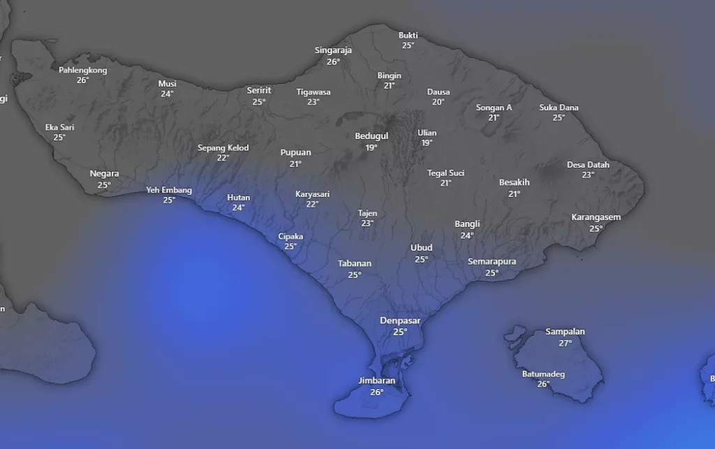
SUNDAY STORM SURGE WARNING – Convective energy over the Bali Strait has reached its peak this morning. Unlike yesterday, severe storm activity is expected to arrive earlier, before midday. Intense thunderstorms combined with strong, persistent winds are likely to disrupt weekend mobility across the island, particularly in tourist-heavy areas.
1. Daily Forecast Summary & RealFeel
Sources: AccuWeather & Weather Underground
| Parameter | Today’s Forecast | Key Notes |
|---|---|---|
| Air Temperature | 25°C – 31°C | Morning air feels dense and heavily saturated. |
| RealFeel Temperature | 37°C – 38°C | Extreme heat index before storms develop; risk of heat exhaustion. |
| Peak Rain Window | 11:30 – 17:00 WITA | Longer-lasting thunderstorms compared to Saturday. |
| Wind Speed | 35 – 65 km/h | Strong, sustained winds; unsecured objects may become airborne. |
2. Regional Weather Forecast (Key Areas)
Sources: Windy.com & BMKG
- Ubud & Central Bali – RED ALERT LEVEL
After more than 10 consecutive days of rainfall, soil stability around Jalan Raya Ubud and surrounding areas is at its most fragile. Landslide risk is extremely high. The Desa Mas alternative route is expected to suffer severe congestion due to weekend traffic. - Canggu, Kuta & Seminyak
Heavy rain with onshore winds blowing directly from the sea. High-risk of deep water pooling in low-lying shortcut roads. - Uluwatu & Bukit Peninsula
Very strong gusty winds along cliff roads. Visitors are strongly advised not to stand close to cliff edges.
3. High-Risk Zones and Safety Alerts
Source: BMKG Hydrometeorological Analysis
- Geological Emergency (Landslides)
Primary concern across steep slopes in Gianyar, Bangli, and Karangasem. Avoid rural roads that run alongside river cliffs during rainfall. - Falling Trees and Structures
Referencing recent incidents in Puspem Badung, parking under roadside trees or billboards is strictly discouraged. Today’s wind strength is sufficient to snap large branches. - Lightning Threat
Immediately suspend all outdoor activities, including swimming in pools or the ocean, once dark storm clouds approach.

4. Maritime and Transport Conditions
Source: Windy.com ECMWF Model
- Wave Height
Southern Indian Ocean swell reaches 4.5 – 6.0 meters. STATUS: EXTREMELY DANGEROUS. All southern beaches are under strict Balawista supervision with an absolute swimming ban. - Fast Boats & Sea Crossings
Routes from Sanur to Nusa Penida/Lembongan and the Gilimanuk–Ketapang ferry crossing may face temporary closures this afternoon due to strong channel winds. - Flights (DPS – Ngurah Rai Airport)
Expect possible delays caused by reduced visibility and crosswinds during thunderstorm periods.
5. Practical Guidance for Today
| Situation | Recommended Action |
|---|---|
| Travel Plans | If flying or crossing by sea this afternoon, depart early before 11:30 WITA. |
| Property Safety | Secure large umbrellas, balcony furniture, and lightweight items around villas and hotels. |
| Wildlife Awareness | Extreme rain pushes monitor lizards into residential areas. Do not corner them; allow a clear escape path. |
6. Safety Advice for Expats and Tourists in Bali
For Short-Stay Visitors
Avoid coastal viewpoints, cliffside attractions, and marine activities today. Weather impacts may escalate rapidly with minimal warning.
For Long-Term Residents
Stay alert to local traffic diversions and sudden access restrictions, especially in Ubud and hill regions. Minor incidents can quickly cascade into major disruptions.
Bottom Line
Sunday’s risk profile is defined by earlier onset, longer storm duration, and stronger winds than previous days. Conservative planning and early movement are strongly advised.
Forecast References
BMKG official early warnings and hydrometeorological analysis
Windy.com ECMWF wind and swell models
AccuWeather RealFeel and storm timing
Weather Underground community weather stations across Bali


